
River Medway Visitor Chart
Click to see larger image
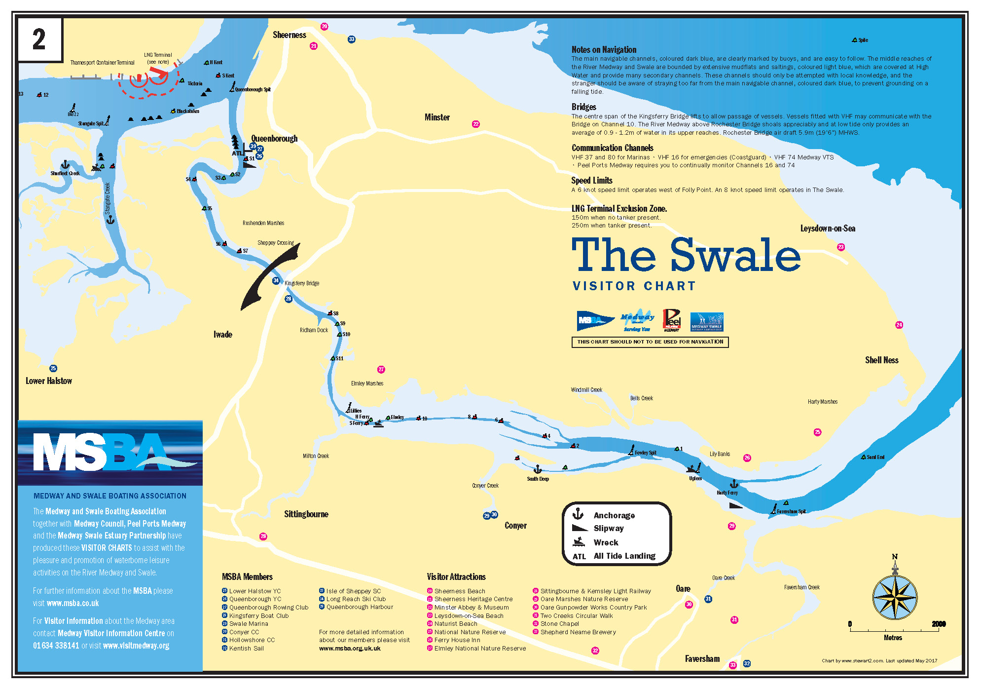
The Swale Visitor Chart
CLICK TO SEE LARGER IMAGE
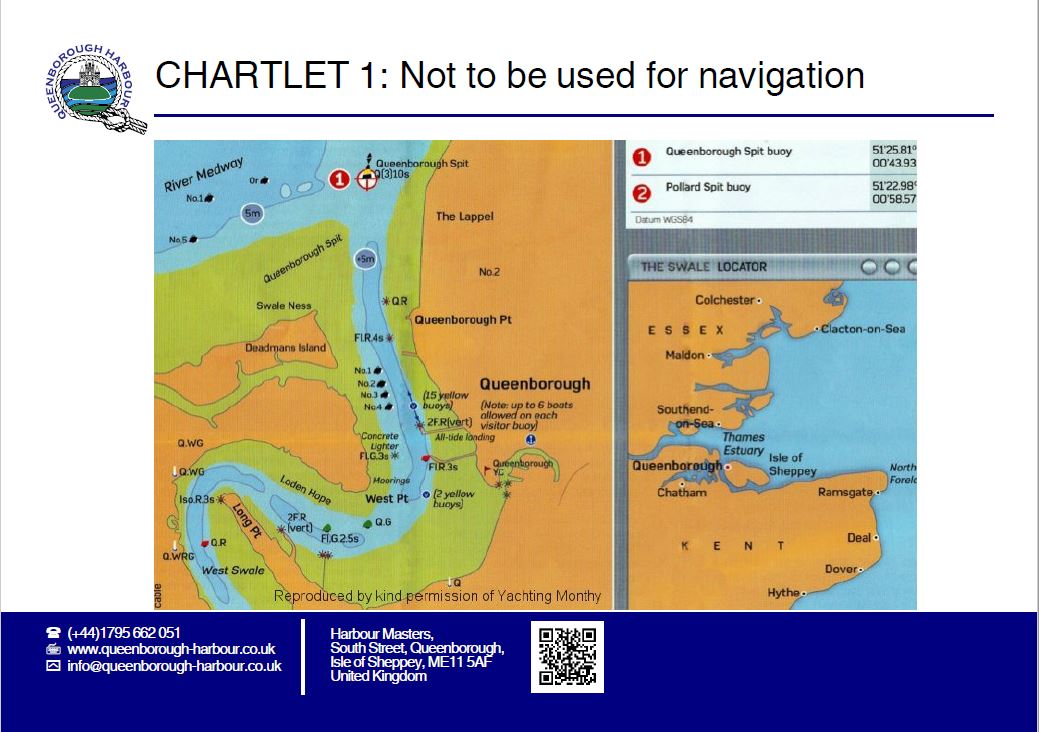
Queenborough Harbour Chart
CLICK TO SEE LARGER IMAGE
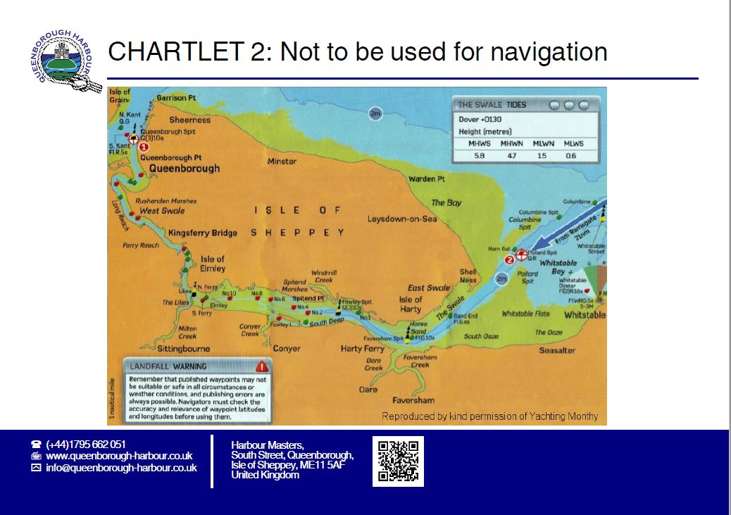
Swale Estuary Chart
CLICK TO SEE LARGER IMAGE

Click to see larger image
CLICK TO SEE LARGER IMAGE
CLICK TO SEE LARGER IMAGE
CLICK TO SEE LARGER IMAGE